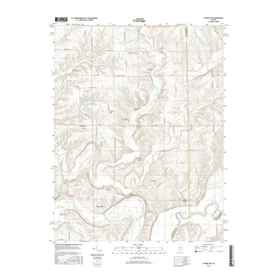
2016 Map of Tunnelton
USGS Topo · Published 2016About this map
The East Fork White River carves a winding path through the southern Lawrence County landscape, defining the rural character around the historic river towns of Tunnelton and Fort Ritner. The terrain is marked by significant topographical formations, including the prominent ridge known as Devils Backbone and the nearby Tunnel Hill. This area is characterized by a mix of deep hollows like Jones Defeat Hollow and elevated landmarks such as Dennison Ridge and Ditney Ridge, illustrating the complex drainage patterns of Guthrie Creek and Back Creek. For those tracing local heritage, the map identifies several burial grounds, including Sherrill Cem, Dodd Cem, and Brown Cem, which are tucked away near the small settlements. North of the river, Pinhook sits at a crossroads, while the waters of Ken-Ray Lake provide a localized point of interest within the predominantly agricultural and forested hillsides.
Find a feature on this map
88 named features on this map. Tap any name to fly to it.
Don’t see what you’re looking for? This feature index may not catch every label — zoom into the map to look around manually.
Map Details
Editions of this 2016 Tunnelton Map
This is the sole edition of this map. No revisions or reprints were ever made.
Other maps of this area

1934 · Bedford
USGS Topo · 1:48,000

1937 · Bedford
USGS Topo · 1:62,500

1950 · Mitchell
USGS Topo · 1:24,000

1951 · Smedley
USGS Topo · 1:24,000

1956 · Vincennes
USGS Topo · 1:250,000

1957 · Vincennes
USGS Topo · 1:250,000

1957 · Campbellsburg
USGS Topo · 1:24,000

1958 · Vincennes
USGS Topo · 1:250,000
1958 · Bartlettsville
USGS Topo · 1:24,000
1958 · Norman
USGS Topo · 1:24,000