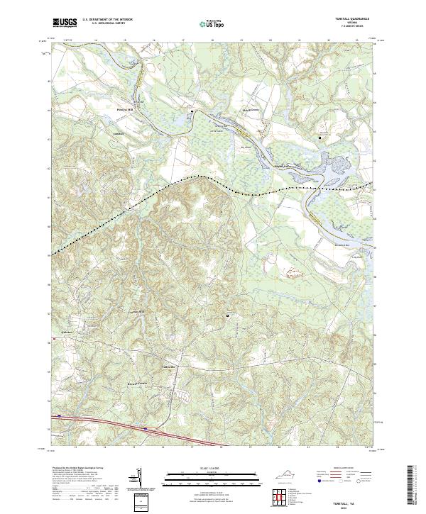
2022 Map of Tunstall
USGS Topo · Published 2022About this map
Putneys Mill and Tunstall highlight the historical landscape of New Kent and King William counties, where the Pamunkey River serves as a natural boundary winding between river bars like Ringer Bar and Gregory Bar. This coastal plain environment is defined by its extensive wetland systems, including Saint Peters Swamp, Pelham Swamp, and Rumley Marsh, which have historically shaped the settlement patterns and agricultural drainage of the region.
Find a feature on this map
113 named features on this map. Tap any name to fly to it.
Don’t see what you’re looking for? This feature index may not catch every label — zoom into the map to look around manually.
Map Details
Editions of this 2022 Tunstall Map
This is the sole edition of this map. No revisions or reprints were ever made.
Other maps of this area

1917 · Toano
USGS Topo · 1:62,500

1918 · Charles City
USGS Topo · 1:62,500

1918 · Toano
USGS Topo · 1:62,500

1919 · New Kent
USGS Topo · 1:62,500

1920 · King William
USGS Topo · 1:62,500

1943 · Richmond
USGS Topo · 1:250,000
1949 · King William
USGS Topo · 1:24,000
1949 · Quinton
USGS Topo · 1:24,000
1949 · King And Queen
USGS Topo · 1:24,000

1949 · Tunstall
USGS Topo · 1:24,000