1948 Map of Tuolumne
USGS Topo · Published 1964About this map
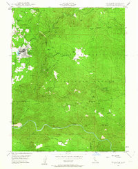
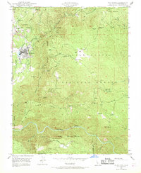
Tuolumne Indian Rancheria and the settlement of Tuolumne anchor the western portion of this mid-century survey, where the rugged terrain of the Stanislaus National Forest meets a legacy of intense resource extraction. The landscape is heavily marked by the region's mining heritage, with numerous sites such as the Arastraville Gold Mine, Columbus Mine, and North Star Mine dotting the hillsides near Arastraville School and Cherokee. These operations, many linked to the early gold rushes of the Sierra foothills, are juxtaposed with the conservation efforts seen at the State Fish Hatchery and the development of public recreation at the Hunter Creek Camp Ground.
Find a feature on this map
50 named features on this map. Tap any name to fly to it.
Don’t see what you’re looking for? This feature index may not catch every label — zoom into the map to look around manually.
Map Details
Editions of this 1948 Tuolumne Map
3 editions found

Other maps of this area

1891 · Big Trees
USGS Topo · 1:125,000

1893 · Sonora
USGS Topo · 1:125,000

1894 · Big Trees
USGS Topo · 1:125,000

1896 · Sonora
USGS Topo · 1:125,000

1897 · Sonora
USGS Topo · 1:125,000

1897 · Big Trees
USGS Topo · 1:125,000

1898 · Sonora
USGS Topo · 1:125,000

1901 · Big Trees
USGS Topo · 1:125,000

1947 · Sacramento
USGS Topo · 1:250,000

1947 · San Jose
USGS Topo · 1:250,000