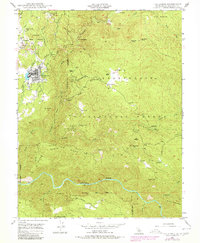
1948 Map of Tuolumne
USGS Topo · Published 1979About this map
Tuolumne and the surrounding gold-bearing canyons appear here as they were mapped in the late 1940s, revealing an landscape where industrial logging and mining intersect with early tribal lands. The Tuolumne Indian Rancheria sits just north of the town center, while the transport infrastructure of the Sierra RR and the Westside Lumber Co RR underscores the era's reliance on rail to move timber and ore from the foothills.
Find a feature on this map
68 named features on this map. Tap any name to fly to it.
Don’t see what you’re looking for? This feature index may not catch every label — zoom into the map to look around manually.
Map Details
Editions of this 1948 Tuolumne Map
3 editions found
Other maps of this area

1891 · Big Trees
USGS Topo · 1:125,000

1893 · Sonora
USGS Topo · 1:125,000

1894 · Big Trees
USGS Topo · 1:125,000

1896 · Sonora
USGS Topo · 1:125,000

1897 · Sonora
USGS Topo · 1:125,000

1897 · Big Trees
USGS Topo · 1:125,000

1898 · Sonora
USGS Topo · 1:125,000

1901 · Big Trees
USGS Topo · 1:125,000

1947 · Sacramento
USGS Topo · 1:250,000

1947 · San Jose
USGS Topo · 1:250,000