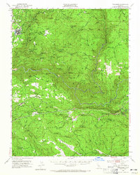
1948 Map of Tuolumne
USGS Topo · Published 1965About this map
The Tuolumne townsite and its surrounding timberlands and mining claims define this mid-century survey of the Stanislaus National Forest. The landscape is a complex network of ridges and watercourses, anchored by the Tuolumne River and the engineered path of the Hetch Hetchy Aqueduct. Remote outposts and family-named landmarks like Gunn Ranch, Rogge Ranch, and Quinn Ranch are scattered across the terrain, reflecting the area's history of high-country ranching and early mountain settlement.
Find a feature on this map
73 named features on this map. Tap any name to fly to it.
Don’t see what you’re looking for? This feature index may not catch every label — zoom into the map to look around manually.
Map Details
Editions of this 1948 Tuolumne Map
4 editions found
Other maps of this area

1891 · Big Trees
USGS Topo · 1:125,000

1893 · Sonora
USGS Topo · 1:125,000

1894 · Big Trees
USGS Topo · 1:125,000

1896 · Dardanelles
USGS Topo · 1:125,000

1896 · Sonora
USGS Topo · 1:125,000

1897 · Sonora
USGS Topo · 1:125,000

1897 · Big Trees
USGS Topo · 1:125,000

1897 · Yosemite
USGS Topo · 1:125,000

1898 · Dardanelles
USGS Topo · 1:125,000

1898 · Sonora
USGS Topo · 1:125,000