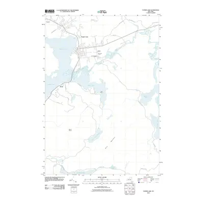
2010 Map of Tupper Lake
USGS Topo · Published 2010About this map
Tupper Lake and its surrounding waterways define this portion of the Adirondack Park at the start of the 21st century. The village of Tupper Lake serves as the central hub, situated where the Raquette River feeds into Raquette Pond. The map reveals a cluster of community landmarks north of the water, including Holy Name Cemetery, Lakeview Cemetery, Beth Joseph Cemetery, and Saint Alphonsus Cemetery, providing valuable data for genealogists tracking local families.
Find a feature on this map
34 named features on this map. Tap any name to fly to it.
Don’t see what you’re looking for? This feature index may not catch every label — zoom into the map to look around manually.
Map Details
Editions of this 2010 Tupper Lake Map
This is the sole edition of this map. No revisions or reprints were ever made.
Other maps of this area

1904 · Long Lake
USGS Topo · 1:62,500

1905 · Saint Regis
USGS Topo · 1:62,500

1907 · Tupper Lake
USGS Topo · 1:62,500

1920 · Childwold
USGS Topo · 1:62,500

1921 · Childwold
USGS Topo · 1:48,000

1922 · Childwold
USGS Topo · 1:62,500

1948 · Ogdensburg
USGS Topo · 1:250,000

1951 · Ogdensburg
USGS Topo · 1:250,000

1953 · Ogdensburg
USGS Topo · 1:250,000

1954 · Tupper Lake
USGS Topo · 1:62,500