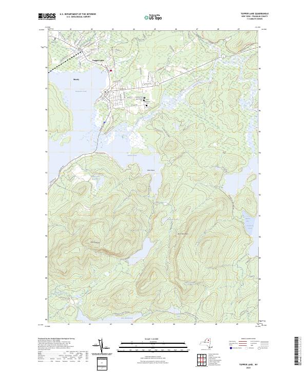
2023 Map of Tupper Lake
USGS Topo · Published 2023About this map
Tupper Lake serves as the focal point for this survey of the northern Adirondack wilderness, where the village streets transition abruptly into dense woods and water. The map documents a cluster of historical burial grounds including Holy Name Cem, Saint Alphonsus Cem, and Beth Joseph Cem, indicating the diverse community history of this logging and resort hub. To the south, the terrain rises sharply toward Mount Morris, overlooking a complex system of waterways including Raquette Pond, Simon Pond, and the winding Raquette River. The presence of the Tupper Lake Reservoir on the slopes of the mountain suggests the engineering required to support the local population. Further into the interior, the map reveals the reaches of the Adirondack Park, where isolated features like Follensby Pond and McBride Pond remain largely untouched by the road network.
Find a feature on this map
70 named features on this map. Tap any name to fly to it.
Don’t see what you’re looking for? This feature index may not catch every label — zoom into the map to look around manually.
Map Details
Editions of this 2023 Tupper Lake Map
This is the sole edition of this map. No revisions or reprints were ever made.
Other maps of this area

1904 · Long Lake
USGS Topo · 1:62,500

1905 · Saint Regis
USGS Topo · 1:62,500

1907 · Tupper Lake
USGS Topo · 1:62,500

1920 · Childwold
USGS Topo · 1:62,500

1921 · Childwold
USGS Topo · 1:48,000

1922 · Childwold
USGS Topo · 1:62,500

1948 · Ogdensburg
USGS Topo · 1:250,000

1951 · Ogdensburg
USGS Topo · 1:250,000

1953 · Ogdensburg
USGS Topo · 1:250,000

1954 · Tupper Lake
USGS Topo · 1:62,500