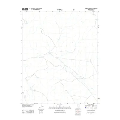
2012 Map of Turkey Canyon NE
USGS Topo · Published 2012About this map
Big Chino Wash defines the drainage pattern of this high-desert landscape in northern Yavapai County, where water management is the primary marker of human activity. The map reveals a sparse network of ranching infrastructure, documented through a series of named water catchments such as Dead Horse Tank, Deer Tank, and Red Hill Tank. These features, alongside the Sullivan Tanks in the northeast, represent the essential points of survival and livestock management in a region otherwise characterized by dry washes and light forest service access. Transportation is limited to a few secondary routes, including the prominent Double Oranch Rd, which navigates the alluvial plains. This survey illustrates the delicate balance of land use in a region where seasonal water flow and scattered tanks dictate the layout of rural ranching operations.
Find a feature on this map
9 named features on this map. Tap any name to fly to it.
Don’t see what you’re looking for? This feature index may not catch every label — zoom into the map to look around manually.
Map Details
Editions of this 2012 Turkey Canyon NE Map
This is the sole edition of this map. No revisions or reprints were ever made.
Other maps of this area

1886 · Chino
USGS Topo · 1:250,000

1891 · Chino
USGS Topo · 1:250,000

1947 · Picacho Butte
USGS Topo · 1:62,500

1947 · Turkey Canyon
USGS Topo · 1:62,500

1948 · Williams
USGS Topo · 1:250,000

1948 · Picacho Butte
USGS Topo · 1:63,360

1950 · Turkey Canyon
USGS Topo · 1:62,500

1950 · Picacho Butte
USGS Topo · 1:62,500

1954 · Williams
USGS Topo · 1:250,000

1956 · Williams
USGS Topo · 1:250,000