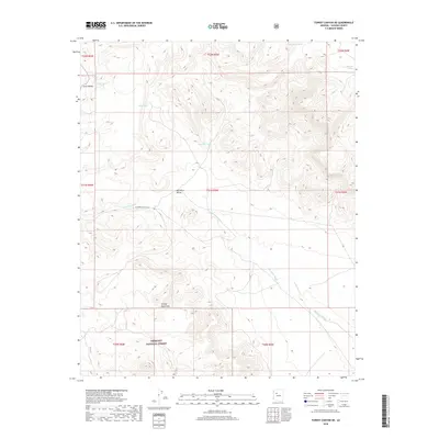
2018 Map of Turkey Canyon NE
USGS Topo · Published 2018About this map
Prescott National Forest encompasses the southern portion of this landscape, where the rising slopes of the Juniper Mountains meet the vast drainage of the Big Chino Valley. This area of Yavapai County is defined by its water management features, critical for ranching and livestock in the arid Arizona interior. Numerous livestock tanks, such as Dead Horse Tank, Maverick Tank, and Sullivan Tanks, are scattered throughout the township sections, indicating the historical and continued reliance on surface water collection. The wide channel of Big Chino Wash winds through the central valley floor, serving as a primary hydrologic corridor. Human activity is marked by the presence of W Double O Ranch Rd, which provides access through the valley, and the distinct boundaries of several sections including t21n r5w and t22n r5w. The map illustrates the transition from the broad valley bottom to the higher, more complex terrain of the neighboring mountains.
Find a feature on this map
18 named features on this map. Tap any name to fly to it.
Don’t see what you’re looking for? This feature index may not catch every label — zoom into the map to look around manually.
Map Details
Editions of this 2018 Turkey Canyon NE Map
This is the sole edition of this map. No revisions or reprints were ever made.
Other maps of this area

1886 · Chino
USGS Topo · 1:250,000

1891 · Chino
USGS Topo · 1:250,000

1947 · Picacho Butte
USGS Topo · 1:62,500

1947 · Turkey Canyon
USGS Topo · 1:62,500

1948 · Williams
USGS Topo · 1:250,000

1948 · Picacho Butte
USGS Topo · 1:63,360

1950 · Turkey Canyon
USGS Topo · 1:62,500

1950 · Picacho Butte
USGS Topo · 1:62,500

1954 · Williams
USGS Topo · 1:250,000

1956 · Williams
USGS Topo · 1:250,000