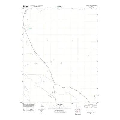
2010 Map of Turkey Knob
USGS Topo · Published 2010About this map
Turkey Knob stands as a central topographic feature in this arid landscape of Garfield County, where drainage systems and high plateaus dictate the geography. The map reveals a sophisticated network of ephemeral watercourses, notably North Wash, Butler Wash, and Cottonwood Wash, which carve through the terrain. Human modification of the environment is represented by the Lone Cedar Reservoir situated on the Lone Cedar Flat, a vital catchment in an area otherwise dominated by desert features. The road system, including Highway 95 and Highway 276, follows the natural contours of the land, navigating between the Poison Spring Benches and deeper incisions like Death Canyon. This 2010 survey provides a clear look at the intersection of modern transportation routes and prehistoric geological formations such as Trachyte Point and Butler Canyon.
Find a feature on this map
15 named features on this map. Tap any name to fly to it.
Don’t see what you’re looking for? This feature index may not catch every label — zoom into the map to look around manually.
Map Details
Editions of this 2010 Turkey Knob Map
This is the sole edition of this map. No revisions or reprints were ever made.
Other maps of this area

1885 · San Rafael
USGS Topo · 1:250,000

1886 · Henry Mountains
USGS Topo · 1:250,000

1892 · Henry Mountains
USGS Topo · 1:250,000

1952 · Orange Cliffs 3 SW
USGS Topo · 1:24,000

1952 · Mount Ellen 4 SW
USGS Topo · 1:24,000

1952 · Mt Pennell 1 NE
USGS Topo · 1:24,000

1952 · Mt Hillers
USGS Topo · 1:62,500

1952 · Mt. Ellen 4 NW
USGS Topo · 1:24,000

1952 · Mt Pennell 1 NW
USGS Topo · 1:24,000

1952 · Hite
USGS Topo · 1:62,500