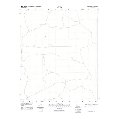
2010 Map of Turkey Ridge
USGS Topo · Published 2010About this map
Turkey Ridge rises as the central geographic feature of this high-desert landscape in Socorro County. The area is defined by its strategic water management, shown through a series of named catchments including State Tank, Sand Tank, and Pothole Tank. These features suggest a reliance on seasonal moisture for ranching or land management in an otherwise arid environment. Of particular interest to local historians is the Turkey Ruins Tank, which references earlier human presence or archaeological remains near the base of the ridge. Transportation is limited to a network of unpaved desert tracks, dominated by the winding course of WSMR S Route 3703, which navigates the undulating terrain and connects these remote water sources.
Find a feature on this map
6 named features on this map. Tap any name to fly to it.
Don’t see what you’re looking for? This feature index may not catch every label — zoom into the map to look around manually.
Map Details
Editions of this 2010 Turkey Ridge Map
This is the sole edition of this map. No revisions or reprints were ever made.
Other maps of this area

1954 · Socorro
USGS Topo · 1:250,000

1958 · Socorro
USGS Topo · 1:250,000

1962 · Socorro
USGS Topo · 1:250,000

1972 · Turkey Ridge
USGS Topo · 1:24,000

1972 · Turkey Ridge SW
USGS Topo · 1:24,000

1972 · Gran Quivira
USGS Topo · 1:24,000
1972 · Chupadera Spring
USGS Topo · 1:24,000

1972 · Chupadera
USGS Topo · 1:24,000

1972 · Bigbee Draw
USGS Topo · 1:24,000

1972 · Wilson Ranch
USGS Topo · 1:24,000