1985 Map of Turley
USGS Topo · Published 1985About this map
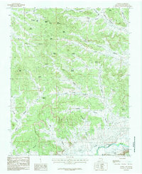
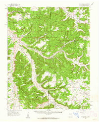
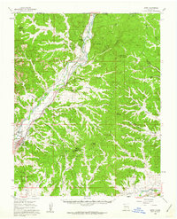
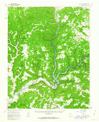
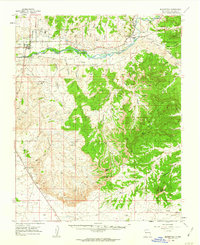
Turley sits at the southern edge of this rugged San Juan County landscape, where the San Juan River and the engineering of the Citizens Ditch define the local irrigation and transport corridor. The terrain to the north is a complex network of high-desert drainage systems, including Hart Canyon, Alamo Canyon, and Caballo Canyon. This mid-1980s provisional survey illustrates a topography dotted with essential water sources like Bootlegger Spring, Pueblito Spring, and Sanchez Spring, which were vital for ranching and survival in this arid environment.
Find a feature on this map
43 named features on this map. Tap any name to fly to it.
Don’t see what you’re looking for? This feature index may not catch every label — zoom into the map to look around manually.
Map Details
Editions of this 1985 Turley Map
This is the sole edition of this map. No revisions or reprints were ever made.
Other maps of this area

1889 · Largo
USGS Topo · 1:250,000

1895 · Largo
USGS Topo · 1:250,000

1954 · Aztec
USGS Topo · 1:250,000

1958 · Aztec
USGS Topo · 1:250,000
1959 · Gould Pass
USGS Topo · 1:62,500
1959 · Aztec
USGS Topo · 1:62,500
1959 · Navajo Dam
USGS Topo · 1:62,500
1960 · Bloomfield
USGS Topo · 1:62,500

1962 · Aztec
USGS Topo · 1:250,000

1965 · Aztec
USGS Topo · 1:250,000