Loading...
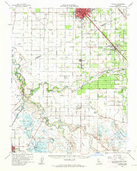
Loading map...1962 Map of Turlock
USGS Topo · Published 1963About this map
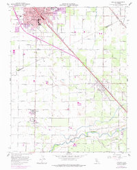
The confluence of the San Joaquin River and the Merced River anchors this 1962 topographical study of the Central Valley. The landscape is defined by an intensive network of irrigation canals, including the Tidewater Canal and numbered laterals like Lateral No 6, which support the agricultural settlements of Hilmar, Irwin, and Stevinson. To the north, the growing urban center of Turlock is bisected by the Southern Pacific railroad and U.S. 99, showing the city's early development patterns and industrial sidings.
Find a feature on this map
67 named features on this map. Tap any name to fly to it.
Don’t see what you’re looking for? This feature index may not catch every label — zoom into the map to look around manually.
Map Details
Date Portrayed1962
Date Published1963
PublisherU.S. Geological Survey
Map TypeTopographic
Scale1:62,500
Physical Dimensions16.6 x 20.7 inches
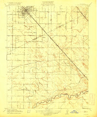
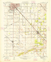
Editions of this 1962 Turlock Map
2 editions found
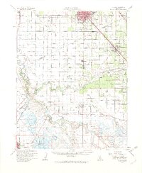
Historical Maps of Turlock Through Time
8 maps found


Featured Locations
Source Details
SourceU.S. Geological Survey
CopyrightPublic Domain