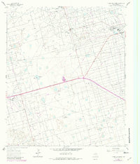
1964 Map of Turnbaugh Corner
USGS Topo · Published 1981About this map
Smith Field and the Lawson Oil Field define this West Texas landscape, illustrating the intensive petroleum development of the mid-20th century. The intricate web of pipelines and access roads connects industrial hubs like the Goldsmith Plant and a local Gasoline Plant, while a large Aqueduct cuts through the northern terrain. Amidst this infrastructure, the rural settlement of Turnbaugh Corner and the Slator Ranch represent the enduring ranching presence in Ector County. An interesting hydrological feature is the ephemeral Cheyenne Lake, which sits in the western section of the quadrangle. The map reflects a period where resource extraction and traditional land use overlapped, evidenced by the numerous pumping stations and gravel pits that dot the landscape near the community of Goldsmith.
Find a feature on this map
12 named features on this map. Tap any name to fly to it.
Don’t see what you’re looking for? This feature index may not catch every label — zoom into the map to look around manually.
Map Details
Editions of this 1964 Turnbaugh Corner Map
2 editions found
Other maps of this area

1954 · Hobbs
USGS Topo · 1:250,000

1954 · Pecos
USGS Topo · 1:250,000

1957 · Pecos
USGS Topo · 1:250,000

1958 · Hobbs
USGS Topo · 1:250,000

1964 · Turnbaugh Corner
USGS Topo · 1:24,000

1964 · Douro
USGS Topo · 1:24,000

1964 · Red Lakes
USGS Topo · 1:24,000

1965 · Goldsmith
USGS Topo · 1:24,000

1967 · North Cowden
USGS Topo · 1:24,000

1968 · Coyote Corner
USGS Topo · 1:24,000