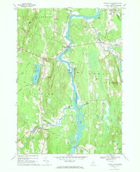
1967 Map of Turner Center
USGS Topo · Published 1969About this map
Androscoggin River flows through the heart of this Maine landscape, defining the boundary between Turner and Leeds as it winds past Griswold Island and Lovewell Island. The mid-century rural character is evident in the dense network of small settlements like South Livermore and Keens Mills, where the local economy and social life were anchored by sites such as the Keens Mills Cemetery. To the west, the topography rises toward Merrill Hill and Torry Hill, overlooking the waters of Pleasant Pond. The confluence of the Nezinscot River and the Androscoggin near Turner Center highlights a historical reliance on these waterways for transport and power. Evidence of early infrastructure remains visible, from the Twin Bridges crossing to the Gaging Station and the Maine Central rail line, which together trace the industrial and transit footprint of Androscoggin County during the late 1960s.
Find a feature on this map
53 named features on this map. Tap any name to fly to it.
Don’t see what you’re looking for? This feature index may not catch every label — zoom into the map to look around manually.
Map Details
Editions of this 1967 Turner Center Map
2 editions found
Other maps of this area

1908 · Poland
USGS Topo · 1:62,500

1908 · Lewiston
USGS Topo · 1:62,500

1910 · Livermore
USGS Topo · 1:62,500

1911 · Buckfield
USGS Topo · 1:62,500

1912 · Livermore
USGS Topo · 1:62,500

1913 · Buckfield
USGS Topo · 1:62,500

1940 · Poland
USGS Topo · 1:62,500

1941 · Livermore
USGS Topo · 1:62,500

1942 · Lewiston
USGS Topo · 1:62,500

1942 · Buckfield
USGS Topo · 1:62,500