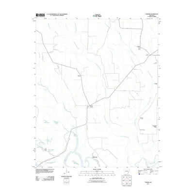
2011 Map of Turner
USGS Topo · Published 2011About this map
Indian Bay and the winding White River dominate the southern portion of this landscape, where a dense network of sloughs and lakes reveals the dynamic nature of the Arkansas Delta. The hydrology here is intricate, with features like Hog Thief Lake, Goose Lake, and Eagle Nest Lake indicating the oxbows and seasonal flooding typical of this riverine environment. The Water Bayou Dam and Water Bayou Reservoir represent modern water management in a region historically defined by its natural bayous and sloughs, such as Dawson Slough and Indian Bayou.
Find a feature on this map
47 named features on this map. Tap any name to fly to it.
Don’t see what you’re looking for? This feature index may not catch every label — zoom into the map to look around manually.
Map Details
Editions of this 2011 Turner Map
This is the sole edition of this map. No revisions or reprints were ever made.
Other maps of this area

1939 · Modoc
USGS Topo · 1:62,500

1939 · Indian Bay
USGS Topo · 1:62,500

1940 · Marvell
USGS Topo · 1:62,500

1940 · Holly Grove
USGS Topo · 1:62,500

1948 · Helena
USGS Topo · 1:250,000

1948 · Modoc
USGS Topo · 1:62,500

1950 · Helena
USGS Topo · 1:250,000

1954 · Indian Bay
USGS Topo · 1:62,500

1955 · Helena
USGS Topo · 1:250,000

1956 · Marvell
USGS Topo · 1:62,500