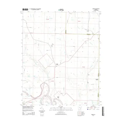
2014 Map of Turner
USGS Topo · Published 2014About this map
The low-lying bottomlands of the White River and its intricate network of sloughs and bayous define this part of the Arkansas Delta. The landscape is a mosaic of agriculture and wetlands, punctuated by the small settlements of Turner, Mayos, and Indian Bay. The boundary between Monroe County and Phillips County cuts north to south through the quadrangle, with the winding paths of Prairie Cypress Creek and Big Cypress Creek shaping the local drainage. Numerous cemeteries, including Valley Grove Cem and Israel Cem, are scattered across the terrain, offering vital touchpoints for genealogists researching family histories in these rural townships. At the southern edge, the Water Bayou Reservoir and several oxbow lakes like Moon Lake and Eagle Nest Lake highlight the shifting course of the river systems that have historically driven the region's economy and settlement patterns.
Find a feature on this map
72 named features on this map. Tap any name to fly to it.
Don’t see what you’re looking for? This feature index may not catch every label — zoom into the map to look around manually.
Map Details
Editions of this 2014 Turner Map
This is the sole edition of this map. No revisions or reprints were ever made.
Other maps of this area

1939 · Modoc
USGS Topo · 1:62,500

1939 · Indian Bay
USGS Topo · 1:62,500

1940 · Marvell
USGS Topo · 1:62,500

1940 · Holly Grove
USGS Topo · 1:62,500

1948 · Helena
USGS Topo · 1:250,000

1948 · Modoc
USGS Topo · 1:62,500

1950 · Helena
USGS Topo · 1:250,000

1954 · Indian Bay
USGS Topo · 1:62,500

1955 · Helena
USGS Topo · 1:250,000

1956 · Marvell
USGS Topo · 1:62,500