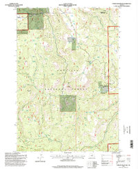
1995 Map of Turner Mountain
USGS Topo · Published 1998About this map
Umatilla National Forest defines this high-elevation landscape along the boundary of Morrow and Grant counties. The terrain is a complex network of ridges and drainages, notably Jack Ridge and the prominent Turner Mountain. Water management for livestock and wildlife is evident through the numerous Stock Pond and named water sources like Sunflower Spring and Big Willow Spring that dot the slopes.
Find a feature on this map
37 named features on this map. Tap any name to fly to it.
Don’t see what you’re looking for? This feature index may not catch every label — zoom into the map to look around manually.
Map Details
Editions of this 1995 Turner Mountain Map
This is the sole edition of this map. No revisions or reprints were ever made.
Other maps of this area

1951 · Monument
USGS Topo · 1:62,500

1953 · Kimberly
USGS Topo · 1:62,500

1953 · Pendleton
USGS Topo · 1:250,000

1955 · Canyon City
USGS Topo · 1:250,000

1956 · Pendleton
USGS Topo · 1:250,000

1959 · Canyon City
USGS Topo · 1:250,000

1969 · Chapin Creek
USGS Topo · 1:24,000

1969 · Madison Butte
USGS Topo · 1:24,000

1969 · Big Rock Flat
USGS Topo · 1:24,000

1980 · Monument
USGS Topo · 1:100,000