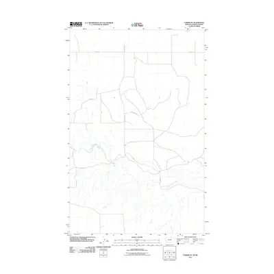
2011 Map of Turner NE
USGS Topo · Published 2011About this map
Woody Island Creek meanders through this portion of Blaine County along the Montana-Saskatchewan border, defining the primary drainage for this high-plains landscape. The area is characterized by a sparse network of local roads that suggest a ranching or agricultural layout, including uniquely named thoroughfares such as Cow Shack Blvd and Pig Spg. Other routes like Hutton Rd, School Bus Rd, and Desaye Rd provide access across the sectioned terrain. The U.S. Geological Survey mapping reveals the subtle topographical shifts near the international boundary, showing a land managed through long-standing property divisions and rural infrastructure like Sids Rd and Cowen Rd.
Find a feature on this map
8 named features on this map. Tap any name to fly to it.
Don’t see what you’re looking for? This feature index may not catch every label — zoom into the map to look around manually.
Map Details
Editions of this 2011 Turner NE Map
This is the sole edition of this map. No revisions or reprints were ever made.
Other maps of this area

1920 · Avery
USGS Topo · 1:125,000

1953 · Havre
USGS Topo · 1:250,000

1957 · Havre
USGS Topo · 1:250,000

1958 · Havre
USGS Topo · 1:250,000

1984 · Chapman
USGS Topo · 1:24,000
1984 · Chapman NW
USGS Topo · 1:24,000

1984 · Turner
USGS Topo · 1:24,000

1984 · Turner NE
USGS Topo · 1:24,000
1984 · Turner NW
USGS Topo · 1:24,000
1984 · Turner SE
USGS Topo · 1:24,000