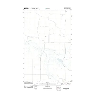
2011 Map of Turner NW
USGS Topo · Published 2011About this map
The Port of Turner marks the northern boundary of this high-plains landscape, where the international border separates Montana from Saskatchewan. This 2011 survey documents a sparsely populated ranching and agricultural region defined more by its water sources and rural road network than by concentrated settlements. Central to the geography is Petri Dam, which manages local water flow along the upper reaches of Woody Island Creek. The drainage patterns are clearly delineated, showing the meandering paths of Buckley Creek as it cuts through the prairie. Long, straight section-line roads like Homestead Rd and Stirling Rd provide the primary infrastructure for the area, reflecting the late 19th-century homesteading patterns that shaped the American West and persist in this contemporary topographic record.
Find a feature on this map
10 named features on this map. Tap any name to fly to it.
Don’t see what you’re looking for? This feature index may not catch every label — zoom into the map to look around manually.
Map Details
Editions of this 2011 Turner NW Map
This is the sole edition of this map. No revisions or reprints were ever made.
Other maps of this area

1913 · Cherry Ridge
USGS Topo · 1:125,000

1920 · Avery
USGS Topo · 1:125,000

1953 · Havre
USGS Topo · 1:250,000

1957 · Havre
USGS Topo · 1:250,000

1958 · Havre
USGS Topo · 1:250,000

1984 · Hogeland SE
USGS Topo · 1:24,000

1984 · Turner
USGS Topo · 1:24,000

1984 · Turner NE
USGS Topo · 1:24,000
1984 · Turner NW
USGS Topo · 1:24,000
1984 · Mosquito Springs
USGS Topo · 1:24,000