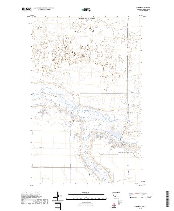
2024 Map of Turner NW
USGS Topo · Published 2024About this map
Woody Island Coulee and the branching waters of Woody Island Creek define this section of the northern Montana plains. The drainage patterns across t37n r25e and t36n r25e illustrate the characteristic topography of Blaine County, where intermittent waterways carve deep into the landscape near the international border. In the southern portion of the map, Buckley Creek creates a rugged series of breaks, contrasted by the systematic grid of rural roads that serve the local agricultural community. Named routes such as Homestead Rd and Mutton Hollow Ln reflect the area’s ranching and settlement history, marking the long-established land divisions of this high-plains environment. The primary north-south artery, Turner Rd, connects these scattered homesteads and pastures across the open terrain.
Find a feature on this map
17 named features on this map. Tap any name to fly to it.
Don’t see what you’re looking for? This feature index may not catch every label — zoom into the map to look around manually.
Map Details
Editions of this 2024 Turner NW Map
This is the sole edition of this map. No revisions or reprints were ever made.
Other maps of this area

1913 · Cherry Ridge
USGS Topo · 1:125,000

1920 · Avery
USGS Topo · 1:125,000

1953 · Havre
USGS Topo · 1:250,000

1957 · Havre
USGS Topo · 1:250,000

1958 · Havre
USGS Topo · 1:250,000

1984 · Hogeland SE
USGS Topo · 1:24,000

1984 · Turner
USGS Topo · 1:24,000

1984 · Turner NE
USGS Topo · 1:24,000
1984 · Turner NW
USGS Topo · 1:24,000
1984 · Mosquito Springs
USGS Topo · 1:24,000