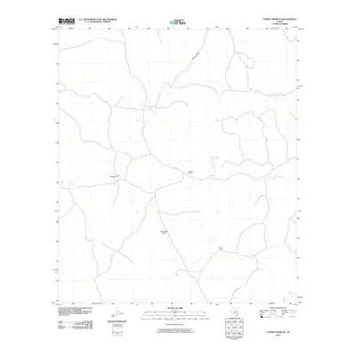
2010 Map of Turney Draw SE
USGS Topo · Published 2010About this map
Buffalo Draw and Wittenburg Draw define the drainage patterns of this Edwards County landscape, where the arid environment shaped a specialized ranching economy. The map documents long-established family operations, most notably Wardlaw Ranch and Turner Ranch, which represent the enduring pastoral heritage of the Texas Hill Country. Connectivity through this sprawling rangeland is maintained by rural routes like Co RD 105 and Co RD 104 E, tracing the paths between isolated holdings. This 2010 survey provides a clear look at the spatial organization of these large land tracts, showing how water features and sparse road networks dictate the placement of ranch headquarters and residential structures in a region where geography remains the primary driver of development.
Find a feature on this map
6 named features on this map. Tap any name to fly to it.
Don’t see what you’re looking for? This feature index may not catch every label — zoom into the map to look around manually.
Map Details
Editions of this 2010 Turney Draw SE Map
This is the sole edition of this map. No revisions or reprints were ever made.
Other maps of this area

1893 · Rock Springs
USGS Topo · 1:125,000

1893 · Nueces
USGS Topo · 1:125,000

1896 · Nueces
USGS Topo · 1:125,000

1943 · Carta Valley
USGS Topo · 1:62,500

1944 · Indian Creek
USGS Topo · 1:62,500

1954 · Sonora
USGS Topo · 1:250,000

1958 · Sonora
USGS Topo · 1:250,000

1958 · Del Rio
USGS Topo · 1:250,000

1964 · Del Rio
USGS Topo · 1:250,000

1970 · Ray Lake NW
USGS Topo · 1:24,000