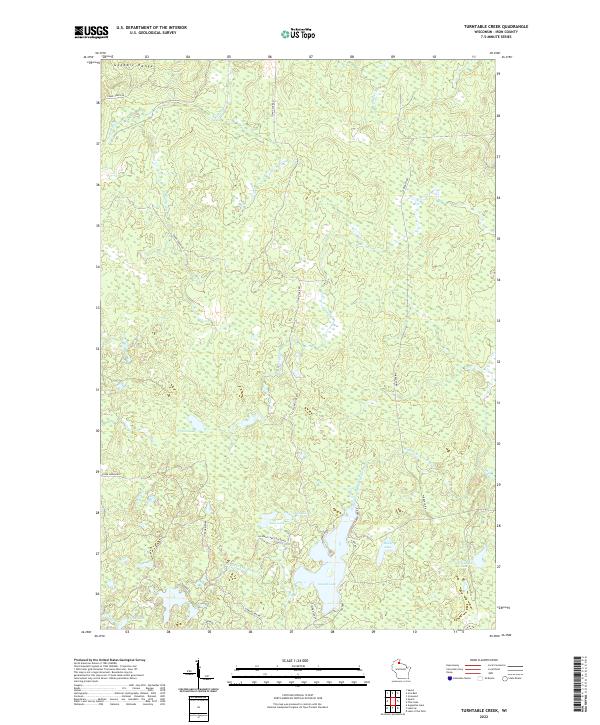
2022 Map of Turntable Creek
USGS Topo · Published 2022About this map
The Gogebic Range forms the northern topographic spine of this region in Iron County, where the landscape is defined by its complex drainage network and numerous kettle lakes. The Potato River flows through the western sections, while the W Fork Montreal River and Mud Cr wind through the eastern townships. This 2022 survey illustrates the modern road network providing access to secluded water bodies like Island Lake, Ruby Lake, and Fifteen Lake. Local transportation is facilitated by thoroughfares such as Island Lake Rd and Lake Obrien Rd, which connect the scattered lakefront areas. Named features like Turntable Creek hint at the area's logging or rail history, even as the map predominantly displays the current hydrography of the t44n r1e and t45n r2e land divisions.
Find a feature on this map
24 named features on this map. Tap any name to fly to it.
Don’t see what you’re looking for? This feature index may not catch every label — zoom into the map to look around manually.
Map Details
Editions of this 2022 Turntable Creek Map
This is the sole edition of this map. No revisions or reprints were ever made.
Other maps of this area

1940 · Mercer
USGS Topo · 1:48,000

1940 · Butternut
USGS Topo · 1:48,000

1940 · Upson
USGS Topo · 1:48,000

1943 · Upson
USGS Topo · 1:48,000

1943 · Ironwood
USGS Topo · 1:48,000

1945 · Mercer
USGS Topo · 1:48,000

1947 · Butternut
USGS Topo · 1:48,000

1947 · Mercer
USGS Topo · 1:48,000

1950 · Butternut
USGS Topo · 1:48,000

1953 · Ashland
USGS Topo · 1:250,000