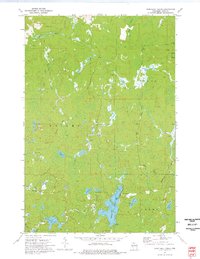
1973 Map of Turntable Creek
USGS Topo · Published 1976About this map
Potato River and the Turntable Creek define this heavily forested landscape in northern Wisconsin during the early 1970s. The region is characterized by an intricate network of waterways and glacial lakes, including Island Lake, Ruby Lake, and Fifteen Lake. While formal settlements are absent, the map reveals the area's industrial past through remnants of the logging and rail era. Lengthy stretches of an Old Railroad Grade and an Old RR Grade wind through the townships of Knight, Pence, and Carey, tracing routes once vital for timber extraction. Small-scale resource activity is noted at a Gravel Pit in the north, while recreation is established at a Campground and Boat Ramp on the eastern shore of Island Lake. The confluence of the West Fork Montreal River and its smaller tributaries like Le Clair Creek highlights a landscape transitioning from active timber production to a seasonal recreational destination.
Find a feature on this map
23 named features on this map. Tap any name to fly to it.
Don’t see what you’re looking for? This feature index may not catch every label — zoom into the map to look around manually.
Map Details
Editions of this 1973 Turntable Creek Map
This is the sole edition of this map. No revisions or reprints were ever made.
Other maps of this area

1940 · Mercer
USGS Topo · 1:48,000

1940 · Butternut
USGS Topo · 1:48,000

1940 · Upson
USGS Topo · 1:48,000

1943 · Upson
USGS Topo · 1:48,000

1943 · Ironwood
USGS Topo · 1:48,000

1945 · Mercer
USGS Topo · 1:48,000

1947 · Butternut
USGS Topo · 1:48,000

1947 · Mercer
USGS Topo · 1:48,000

1950 · Butternut
USGS Topo · 1:48,000

1953 · Ashland
USGS Topo · 1:250,000