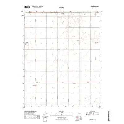
2018 Map of Turpin NE
USGS Topo · Published 2018About this map
The high plains of the Kansas-Oklahoma state line define this 2018 survey, where the boundary between Seward County, Kansas, and Beaver County, Oklahoma, meets. The landscape is organized by a meticulous grid of rural routes, including Hollow N1200 and Hollow E0050, which facilitate movement between scattered homesteads and agricultural plots. This infrastructure supports the small community of Little Ponderosa in the west, a rare concentrated settlement in an area otherwise characterized by vast section lines. Evidence of the region’s long-standing community roots can be found at Union Cem and Turpin Cem, which serve as quiet landmarks among the fields. In the southwestern corner, the drainage of Sharp Cr provides a subtle break in the topographic regularity of the high prairie. The map records a moment of modern rural life, where local developments like Country Estates Rd interface with the traditional township and range system.
Find a feature on this map
39 named features on this map. Tap any name to fly to it.
Don’t see what you’re looking for? This feature index may not catch every label — zoom into the map to look around manually.
Map Details
Editions of this 2018 Turpin NE Map
This is the sole edition of this map. No revisions or reprints were ever made.
Other maps of this area

1954 · Perryton
USGS Topo · 1:250,000

1955 · Dodge City
USGS Topo · 1:250,000

1958 · Perryton
USGS Topo · 1:250,000

1958 · Dodge City
USGS Topo · 1:250,000

1959 · Dodge City
USGS Topo · 1:250,000

1971 · Liberal
USGS Topo · 1:24,000

1971 · Kismet SW
USGS Topo · 1:24,000

1971 · Hayne
USGS Topo · 1:24,000

1973 · Floris
USGS Topo · 1:24,000

1973 · Little Ponderosa
USGS Topo · 1:24,000