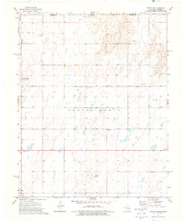
1973 Map of Turpin NE
USGS Topo · Published 1976About this map
The High Plains borderlands of the Oklahoma Panhandle meet Kansas in this early 1970s survey. This portion of Beaver County reflects a landscape primarily defined by the energy industry and rural infrastructure, punctuated by numerous Gas Wells and an Oil Well. Small, localized gathering points serve the farming and ranching community, such as the Tarpin Ch and the Roadside Park located along the primary east-west highway. For genealogists, the map preserves the locations of vital community landmarks including Union Cem and Turpin Cem. The small settlement of Little Ponderosa sits near the western edge of the quadrangle, representing the sparse but resilient residential footprint in this semi-arid region near the state line.
Find a feature on this map
11 named features on this map. Tap any name to fly to it.
Don’t see what you’re looking for? This feature index may not catch every label — zoom into the map to look around manually.
Map Details
Editions of this 1973 Turpin NE Map
This is the sole edition of this map. No revisions or reprints were ever made.
Other maps of this area

1954 · Perryton
USGS Topo · 1:250,000

1955 · Dodge City
USGS Topo · 1:250,000

1958 · Perryton
USGS Topo · 1:250,000

1958 · Dodge City
USGS Topo · 1:250,000

1959 · Dodge City
USGS Topo · 1:250,000

1971 · Liberal
USGS Topo · 1:24,000

1971 · Kismet SW
USGS Topo · 1:24,000

1971 · Hayne
USGS Topo · 1:24,000

1973 · Floris
USGS Topo · 1:24,000

1973 · Little Ponderosa
USGS Topo · 1:24,000