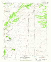
1952 Map of Turquoise Hill
USGS Topo · Published 1967About this map
Historic Spanish land grants define the geography of this mid-century New Mexico landscape, dominated by the Cieneguilla Grant, Pacheco Grant, and Sitio De Los Cerrillos Grant. The terrain is marked by a network of dry washes including Arroyo Hondo, Arroyo de los Chamisos, and Cienega Creek, which reveal the region's complex drainage patterns. Local religious and educational life is anchored by St Joseph Church, the Cieneguilla Church, and the Cienega School.
Find a feature on this map
27 named features on this map. Tap any name to fly to it.
Don’t see what you’re looking for? This feature index may not catch every label — zoom into the map to look around manually.
Map Details
Editions of this 1952 Turquoise Hill Map
3 editions found
Other maps of this area

1889 · Santa Fe
USGS Topo · 1:125,000

1892 · San Pedro
USGS Topo · 1:125,000

1892 · Santa Clara
USGS Topo · 1:125,000

1894 · Santa Fe
USGS Topo · 1:125,000

1894 · Lamy
USGS Topo · 1:125,000

1951 · Agua Fria
USGS Topo · 1:24,000

1951 · Turquoise Hill
USGS Topo · 1:24,000

1952 · Santa Fe
USGS Topo · 1:24,000

1952 · Turquoise Hill
USGS Topo · 1:24,000

1952 · Seton Village
USGS Topo · 1:24,000