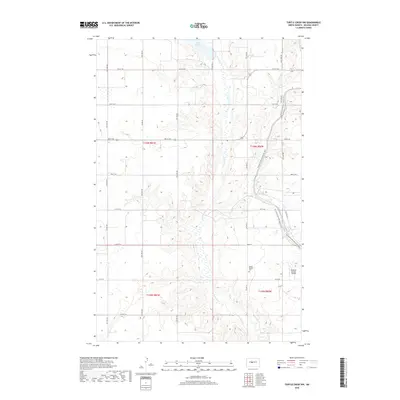
2018 Map of Turtle Creek NW
USGS Topo · Published 2018About this map
Turtle Creek winds through the heart of this McLean County landscape, carving a drainage pattern through the glacial prairie south of Lake Ordway. The area is characterized by the structured grid of the Public Land Survey System, where section lines dictate the paths of rural routes like 5th St NW and Co Hwy 16. The presence of the Bethal Baptist Cem and the Philbrick Private Airstrip indicates a quiet, established rural community centered on family landholdings and small-scale transit. Of particular interest to modern hikers and historians is the N Country National Scenic Trail, which meanders across the eastern sections of the quadrangle, following the natural contours of the land rather than the rigid township grid, offering a rare diagonal contrast to the surrounding agricultural geometry.
Find a feature on this map
19 named features on this map. Tap any name to fly to it.
Don’t see what you’re looking for? This feature index may not catch every label — zoom into the map to look around manually.
Map Details
Editions of this 2018 Turtle Creek NW Map
This is the sole edition of this map. No revisions or reprints were ever made.
Other maps of this area

1929 · Coleharbor
USGS Topo · 1:62,500

1947 · Turtle Lake
USGS Topo · 1:62,500

1949 · Turtle Creek
USGS Topo · 1:62,500

1949 · Washburn
USGS Topo · 1:62,500

1954 · McClusky
USGS Topo · 1:250,000

1958 · McClusky
USGS Topo · 1:250,000

1961 · Turtle Creek SW
USGS Topo · 1:24,000

1961 · Turtle Lake
USGS Topo · 1:24,000

1961 · Lake Nettie
USGS Topo · 1:24,000

1961 · Washburn
USGS Topo · 1:24,000