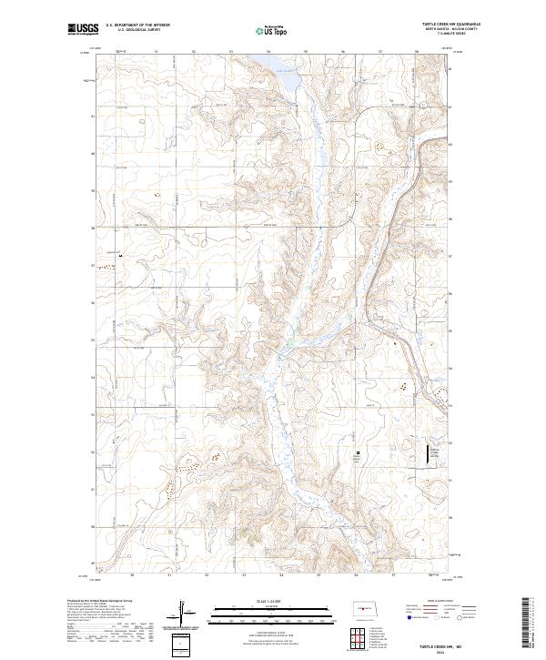
2024 Map of Turtle Creek NW
USGS Topo · Published 2024About this map
Turtle Creek winds through the rolling North Dakota prairie of McLean County, anchoring a landscape dedicated to conservation and agricultural grid-work. The McLean County Waterfowl Production Area occupies several non-contiguous sections, highlighting the region's importance for migratory birds and the preservation of natural wetlands like Lake Ordway. Local history is anchored at the Ingersoll Cem and the Bethal Baptist Cem, which sit among the section lines and township boundaries of T146N and T145N. The presence of the North Country National Scenic Trl cutting through the southeastern corner alongside the Philbrick Private Airstrip illustrates the modern blend of recreational transit and private utility in this rural stretch north of the Missouri River valley.
Find a feature on this map
22 named features on this map. Tap any name to fly to it.
Don’t see what you’re looking for? This feature index may not catch every label — zoom into the map to look around manually.
Map Details
Editions of this 2024 Turtle Creek NW Map
This is the sole edition of this map. No revisions or reprints were ever made.
Other maps of this area

1929 · Coleharbor
USGS Topo · 1:62,500

1947 · Turtle Lake
USGS Topo · 1:62,500

1949 · Turtle Creek
USGS Topo · 1:62,500

1949 · Washburn
USGS Topo · 1:62,500

1954 · McClusky
USGS Topo · 1:250,000

1958 · McClusky
USGS Topo · 1:250,000

1961 · Turtle Creek SW
USGS Topo · 1:24,000

1961 · Turtle Lake
USGS Topo · 1:24,000

1961 · Lake Nettie
USGS Topo · 1:24,000

1961 · Washburn
USGS Topo · 1:24,000