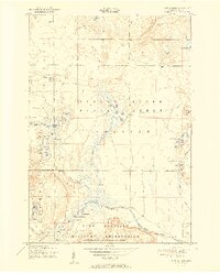
1951 Map of Turtle Lake
USGS Topo · Published 1951About this map
Camp Grayling Military Reservation occupies the southern portion of this landscape, its northern boundary cutting through the forests and wetlands near Rosecrans Hill. The topography is dominated by an intricate network of water, with the North Branch Au Sable River winding across the terrain and feeding numerous glacial lakes like Turtle Lake and Opal Lake.
Find a feature on this map
45 named features on this map. Tap any name to fly to it.
Don’t see what you’re looking for? This feature index may not catch every label — zoom into the map to look around manually.
Map Details
Editions of this 1951 Turtle Lake Map
2 editions found
Other maps of this area

1949 · Lewiston
USGS Topo · 1:62,500

1949 · Otsego Lake
USGS Topo · 1:62,500

1950 · Johannesburg
USGS Topo · 1:24,000

1950 · Lovells
USGS Topo · 1:24,000

1950 · Turtle Lake
USGS Topo · 1:24,000

1951 · K P Lake
USGS Topo · 1:24,000

1951 · Big Bradford Lake
USGS Topo · 1:24,000

1951 · Lovells
USGS Topo · 1:24,000

1951 · Turtle Lake
USGS Topo · 1:24,000

1951 · Otsego Lake
USGS Topo · 1:24,000