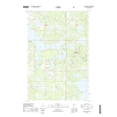
2019 Map of Turtle River Lake
USGS Topo · Published 2019About this map
Turtle River lies at the heart of this lake-heavy corridor in Beltrami County, where the eponymous Turtle River flows through a sequence of glacial basins. The settlement serves as a gateway to the western edge of the Chippewa National Forest, a landscape defined by an intricate network of waterways including Turtle River Lake, Gull Lake, and Meadow Lake. The drainage pattern is complex, with the Gull River connecting several smaller bodies of water in the northern sections of the map.
Find a feature on this map
54 named features on this map. Tap any name to fly to it.
Don’t see what you’re looking for? This feature index may not catch every label — zoom into the map to look around manually.
Map Details
Editions of this 2019 Turtle River Lake Map
This is the sole edition of this map. No revisions or reprints were ever made.
Other maps of this area

1920 · Buena Vista
USGS Topo · 1:62,500

1954 · Bemidji
USGS Topo · 1:250,000

1957 · Bemidji
USGS Topo · 1:250,000

1958 · Bemidji
USGS Topo · 1:250,000

1968 · Bemidji East
USGS Topo · 1:24,000
1972 · Blackduck
USGS Topo · 1:24,000

1972 · Turtle River Lake
USGS Topo · 1:24,000
1972 · Pimushe Lake
USGS Topo · 1:24,000

1972 · White Fish Lake
USGS Topo · 1:24,000
1972 · Turtle River
USGS Topo · 1:24,000