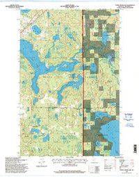
1996 Map of Turtle River Lake
USGS Topo · Published 1998About this map
Buena Vista State Forest and the Chippewa National Forest dominate this Northern Minnesota landscape, where a dense network of glacial lakes and wetlands defines the local geography. The massive form of Turtle River Lake snakes through the center of the map, fed by the winding Turtle River. This area, updated in the mid-1990s, reveals a territory structured by conservation and administrative boundaries, including the Bemidji Game Refuge and a portion of the Leech Lake Indian Reservation.
Find a feature on this map
23 named features on this map. Tap any name to fly to it.
Don’t see what you’re looking for? This feature index may not catch every label — zoom into the map to look around manually.
Map Details
Editions of this 1996 Turtle River Lake Map
This is the sole edition of this map. No revisions or reprints were ever made.
Other maps of this area

1920 · Buena Vista
USGS Topo · 1:62,500

1954 · Bemidji
USGS Topo · 1:250,000

1957 · Bemidji
USGS Topo · 1:250,000

1958 · Bemidji
USGS Topo · 1:250,000

1968 · Bemidji East
USGS Topo · 1:24,000
1972 · Blackduck
USGS Topo · 1:24,000

1972 · Turtle River Lake
USGS Topo · 1:24,000
1972 · Pimushe Lake
USGS Topo · 1:24,000

1972 · White Fish Lake
USGS Topo · 1:24,000
1972 · Turtle River
USGS Topo · 1:24,000