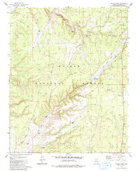
1979 Map of Tusayan West
USGS Topo · Published 1980About this map
Tusayan stands as a primary gateway to the South Rim, situated at a transition between the Grand Canyon National Park boundary and the surrounding Kaibab National Forest. The landscape is dominated by the dry drainage of Coconino Wash and the rugged Long Jim Canyon to the northeast. Transportation and infrastructure patterns reflect the era's reliance on rail and aviation, with the Atchison Topeka and Santa Fe railroad cutting across the northern reaches and an Airway Beacon positioned to guide regional flight paths. Because of the arid high-desert environment, water management is the most visible sign of human engineering on the map. A sophisticated network of reservoirs and tanks, including Rain Tank, Boggy Tank, and the Ranger Tank, are strategically distributed across the forest for ranching or forestry needs. Small-scale industrial activity is noted through scattered Borrow Pit and Prospects labels, while the high point at Apex provides a clear topographic landmark amidst the forest terrain.
Find a feature on this map
21 named features on this map. Tap any name to fly to it.
Don’t see what you’re looking for? This feature index may not catch every label — zoom into the map to look around manually.
Map Details
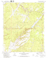
Editions of this 1979 Tusayan West Map
2 editions found
Other maps of this area

1886 · Chino
USGS Topo · 1:250,000

1886 · Kaibab
USGS Topo · 1:250,000

1891 · Chino
USGS Topo · 1:250,000

1903 · Bright Angel
USGS Topo · 1:48,000

1906 · Bright Angel
USGS Topo · 1:48,000

1948 · Williams
USGS Topo · 1:250,000

1953 · Grand Canyon
USGS Topo · 1:250,000

1954 · Williams
USGS Topo · 1:250,000
1956 · Red Butte SE
USGS Topo · 1:24,000

1956 · Williams
USGS Topo · 1:250,000