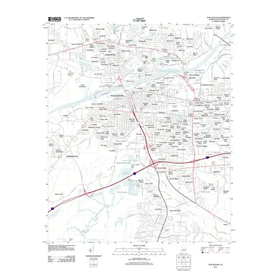
2011 Map of Tuscaloosa
USGS Topo · Published 2011About this map
The Black Warrior River serves as the central artery for this part of Alabama, dividing the landscape between the city of Tuscaloosa and its northern neighbor, Northport. The map details the dense campus of the University of Alabama, where landmarks like Denny Chimes and Memorial Coliseum anchor the collegiate district. The river's industrial and transit legacy is evidenced by the Docks Tuscaloosa-Northport Terminal and the Hugh R Thomas Bridge, alongside newer infrastructure such as William Bacon Oliver Lake.
Find a feature on this map
222 named features on this map. Tap any name to fly to it.
Don’t see what you’re looking for? This feature index may not catch every label — zoom into the map to look around manually.
Map Details
Editions of this 2011 Tuscaloosa Map
This is the sole edition of this map. No revisions or reprints were ever made.
Other maps of this area

1899 · Brookwood
USGS Topo · 1:125,000

1924 · Tuscaloosa
USGS Topo · 1:62,500

1926 · Samantha
USGS Topo · 1:48,000

1926 · Tuscaloosa
USGS Topo · 1:62,500

1928 · Samantha
USGS Topo · 1:62,500

1929 · Searles
USGS Topo · 1:48,000

1931 · Cottondale
USGS Topo · 1:48,000

1934 · Searles
USGS Topo · 1:62,500

1934 · Cottondale
USGS Topo · 1:62,500

1953 · Birmingham
USGS Topo · 1:250,000