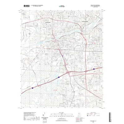
2020 Map of Tuscaloosa
USGS Topo · Published 2020About this map
The Black Warrior River carves through this Alabama landscape, separating Northport from the expanding urban core of Tuscaloosa. As of 2020, the area is defined by its prominent academic and civic institutions, most notably The University of Alabama and Stillman College. The map reveals the intricate network of neighborhoods and historic hills that characterize the riverfront, including Childress Hill, River Hill, and Holman Hill. Crossing the water, the Woolsey Finnell Bridge and Hugh R Thomas Bridge serve as critical arteries for a city deeply integrated with its riverine geography.
Find a feature on this map
75 named features on this map. Tap any name to fly to it.
Don’t see what you’re looking for? This feature index may not catch every label — zoom into the map to look around manually.
Map Details
Editions of this 2020 Tuscaloosa Map
This is the sole edition of this map. No revisions or reprints were ever made.
Other maps of this area

1899 · Brookwood
USGS Topo · 1:125,000

1924 · Tuscaloosa
USGS Topo · 1:62,500

1926 · Samantha
USGS Topo · 1:48,000

1926 · Tuscaloosa
USGS Topo · 1:62,500

1928 · Samantha
USGS Topo · 1:62,500

1929 · Searles
USGS Topo · 1:48,000

1931 · Cottondale
USGS Topo · 1:48,000

1934 · Searles
USGS Topo · 1:62,500

1934 · Cottondale
USGS Topo · 1:62,500

1953 · Birmingham
USGS Topo · 1:250,000