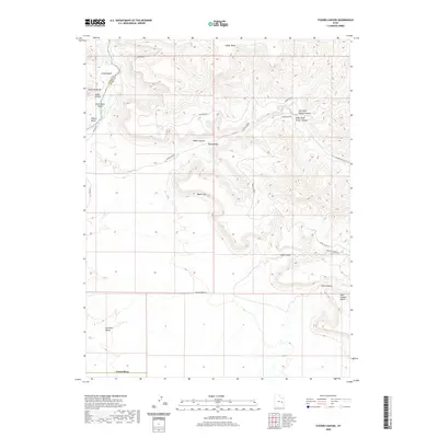
2020 Map of Tusher Canyon
USGS Topo · Published 2020About this map
The Green River carves a deep, sinuous path through the northwestern corner of this quadrangle, defining the geological transition from the Green River Valley into the high-relief terrain of Gray Canyon. Dominating the riverbank, Gunnison Butte serves as a prominent landmark overlooking Willow Bend. To the east, the landscape rises sharply into the formidable Book Cliffs, a massive escarpment that dictates the drainage patterns for Tusher Canyon and Coal Canyon.
Find a feature on this map
22 named features on this map. Tap any name to fly to it.
Don’t see what you’re looking for? This feature index may not catch every label — zoom into the map to look around manually.
Map Details
Editions of this 2020 Tusher Canyon Map
This is the sole edition of this map. No revisions or reprints were ever made.
Other maps of this area

1885 · San Rafael
USGS Topo · 1:250,000

1885 · East Tavaputs
USGS Topo · 1:250,000

1885 · La Sal
USGS Topo · 1:250,000

1886 · Price River
USGS Topo · 1:250,000

1896 · Price River
USGS Topo · 1:250,000

1954 · Tidwell 1 NE
USGS Topo · 1:24,000

1954 · Tidwell 1 NW
USGS Topo · 1:24,000

1954 · Green River
USGS Topo · 1:62,500

1956 · Salina
USGS Topo · 1:250,000

1956 · Price
USGS Topo · 1:250,000