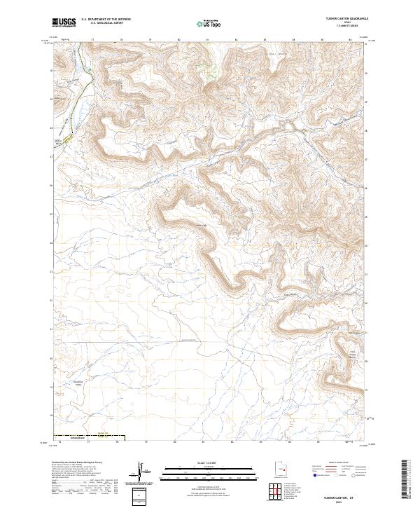
2023 Map of Tusher Canyon
USGS Topo · Published 2023About this map
The Green Wild and Scenic River carves a path through the northwestern corner of this quadrangle, defining the border between Emery and Grand counties. This high-desert landscape is dominated by the dramatic rise of the Book Cliffs, which separate the expansive Mancos Desert W to the south from the intricate canyon systems above. The topographical detail reveals a network of drainage features including Tusher Canyon, Horse Canyon, and Tusher Wash, all of which feed toward the Green River Valley. Landmarks such as Gunnison Butte and Suluar Mesa provide vertical orientation in a region defined by its benches and mesas. Apart from Beach Rd, the area remains largely undeveloped, showcasing the raw geological formations and natural river corridor of eastern Utah as they appeared in the early 21st century.
Find a feature on this map
23 named features on this map. Tap any name to fly to it.
Don’t see what you’re looking for? This feature index may not catch every label — zoom into the map to look around manually.
Map Details
Editions of this 2023 Tusher Canyon Map
This is the sole edition of this map. No revisions or reprints were ever made.
Other maps of this area

1885 · San Rafael
USGS Topo · 1:250,000

1885 · East Tavaputs
USGS Topo · 1:250,000

1885 · La Sal
USGS Topo · 1:250,000

1886 · Price River
USGS Topo · 1:250,000

1896 · Price River
USGS Topo · 1:250,000

1954 · Tidwell 1 NE
USGS Topo · 1:24,000

1954 · Tidwell 1 NW
USGS Topo · 1:24,000

1954 · Green River
USGS Topo · 1:62,500

1956 · Salina
USGS Topo · 1:250,000

1956 · Price
USGS Topo · 1:250,000