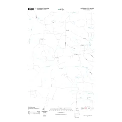
2013 Map of Twelvefoot Falls
USGS Topo · Published 2013About this map
Twelvefoot Falls and a series of cascading cataracts along the Pike River system define this northern Wisconsin landscape. This area of Marinette County is characterized by the complex branching of the river, including the North Branch Pike River, the S Br Pike River, and the Little S Br Pike River. The topography is marked by notable hydraulic features such as Eighteenfoot Falls, Eightfoot Falls, and Horseshoe Falls, as well as the Carney Rapids to the north. Numerous small lakes and ponds are scattered throughout the forested terrain, including Kidd Lake, Phillips Lake, and the uniquely named Disney Lake near the southern boundary. A network of county forest roads, such as Co Forest Road 505 and Co Forest Road 513, provides access to the various shorelines and recreation areas within the timberlands.
Find a feature on this map
38 named features on this map. Tap any name to fly to it.
Don’t see what you’re looking for? This feature index may not catch every label — zoom into the map to look around manually.
Map Details
Editions of this 2013 Twelvefoot Falls Map
This is the sole edition of this map. No revisions or reprints were ever made.
Other maps of this area

1939 · Dunbar
USGS Topo · 1:48,000

1939 · Goodman
USGS Topo · 1:48,000

1940 · Thunder Mtn.
USGS Topo · 1:48,000

1940 · Athelstane
USGS Topo · 1:48,000

1941 · Dunbar
USGS Topo · 1:48,000

1942 · Athelstane
USGS Topo · 1:48,000

1946 · Goodman
USGS Topo · 1:48,000

1947 · Dunbar
USGS Topo · 1:48,000

1951 · Thunder Mountain
USGS Topo · 1:48,000

1954 · Iron Mountain
USGS Topo · 1:250,000