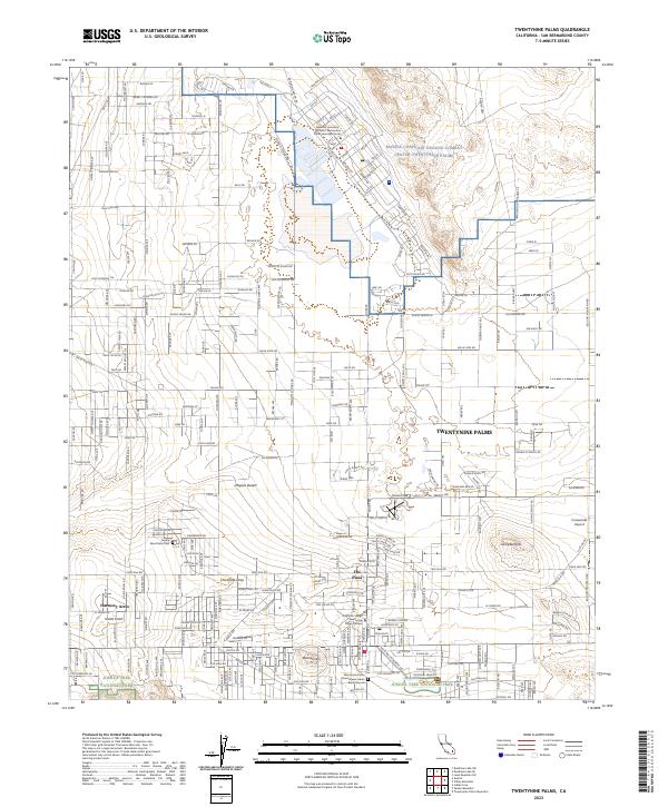
2023 Map of Twentynine Palms
USGS Topo · Published 2023About this map
Joshua Tree National Park borders the southern edge of this desert community, where the rugged peaks of the Mojave Desert meet a growing residential grid. The map highlights the unique cultural landscape of the region, including the Twentynine Palms Chemehuevi Indian Burial Ground and the Nine Palms Cem. Settlement patterns show distinct clusters such as Harmony Acres and The Plaza, while the vast Marine Corps Air Ground Combat Center Twentynine Palms dominates the northern and eastern reaches. Topographical features like the distinctive Chocolate Drop and Campbell Hill provide natural landmarks amidst a network of desert roads. This survey illustrates the modern intersection of military operations, tribal heritage, and national park preservation within the San Bernardino County high desert.
Find a feature on this map
230 named features on this map. Tap any name to fly to it.
Don’t see what you’re looking for? This feature index may not catch every label — zoom into the map to look around manually.
Map Details
Editions of this 2023 Twentynine Palms Map
This is the sole edition of this map. No revisions or reprints were ever made.
Other maps of this area

1942 · Amboy
USGS Topo · 1:250,000

1943 · Amboy
USGS Topo · 1:250,000

1953 · San Bernardino
USGS Topo · 1:250,000

1954 · Needles
USGS Topo · 1:250,000

1954 · Valley Mtn
USGS Topo · 1:24,000

1955 · Deadman Lake SE
USGS Topo · 1:24,000

1955 · Deadman Lake SW
USGS Topo · 1:24,000

1955 · Lead Mountain SW
USGS Topo · 1:24,000

1955 · Twentynine Palms
USGS Topo · 1:24,000

1955 · Twentynine Palms
USGS Topo · 1:62,500
Featured Places
- Twentynine Palms, CA
- Harmony Acres, Twentynine Palms
- Smoke Tree, Twentynine Palms
- San Bernardino County, CA
- United States