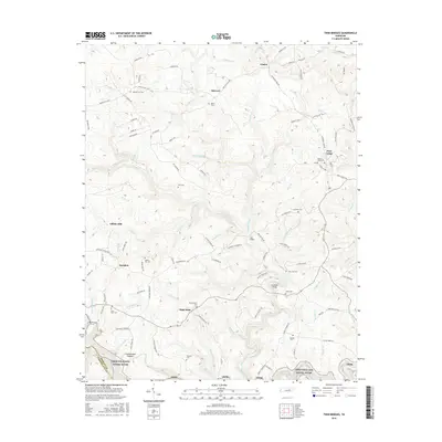
2016 Map of Twin Bridges
USGS Topo · Published 2016About this map
The Cumberland Plateau landscape defines this section of the Tennessee highlands, where small communities like Deer Lodge and High Point are connected by a web of local roads such as Deer Lodge HWY and Nashville Ave. Settlement patterns are closely tied to the complex drainage systems of White Creek and Cook Creek, with many family names preserved in the numerous burial grounds scattered throughout the hills. Genealogists may find value in the locations of the Meister Hill Cem, Branstetters Cem, and Myers Cem. The southern edge of the map features the protected corridor of the Obed Wild and Scenic River, contrasting with the more developed areas near Adkins Mill. Landmarks such as Twin Bridges and the Lavender Bridge indicate established crossings over the region's many winding branches and creeks.
Find a feature on this map
111 named features on this map. Tap any name to fly to it.
Don’t see what you’re looking for? This feature index may not catch every label — zoom into the map to look around manually.
Map Details
Editions of this 2016 Twin Bridges Map
This is the sole edition of this map. No revisions or reprints were ever made.
Other maps of this area

1895 · Wartburg
USGS Topo · 1:125,000

1896 · Wartburg
USGS Topo · 1:125,000

1935 · Lancing
USGS Topo · 1:24,000

1935 · Pilot Mountain
USGS Topo · 1:24,000

1936 · Hebbertsburg
USGS Topo · 1:24,000

1936 · Fox Creek
USGS Topo · 1:24,000

1936 · Twin Bridges
USGS Topo · 1:24,000

1936 · Jones Knob
USGS Topo · 1:24,000
1943 · Hebbertsburg
USGS Topo · 1:24,000

1943 · Twin Bridges
USGS Topo · 1:24,000