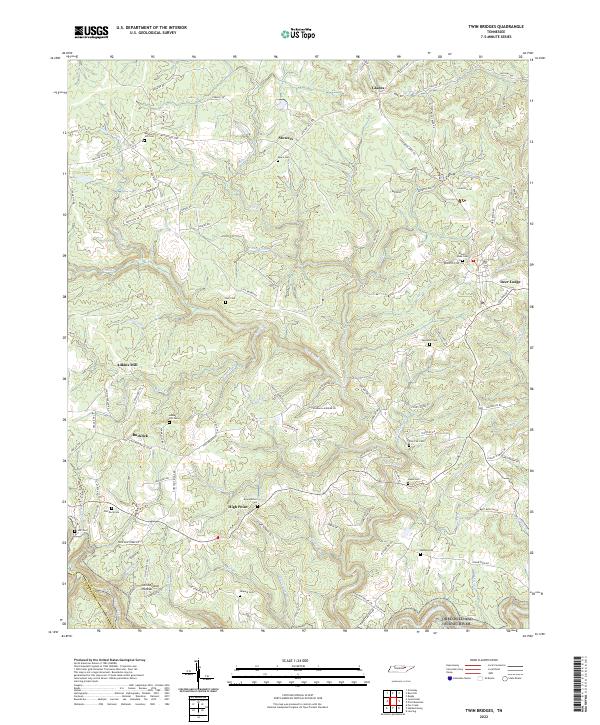
2022 Map of Twin Bridges
USGS Topo · Published 2022About this map
The Cumberland Plateau defines the landscape of this portion of Tennessee, characterized by deep-cut stream valleys and high wooded ridges. Small agricultural and residential clusters like Stowers, High Point, and Bucklick are connected by a network of rural roads such as Meister Hills Rd and Twin Bridge Rd. The area is particularly rich in family-named landmarks and historical sites, including several cemeteries such as Meister Hill Cem, Branstetters Cem, and Nell Cem, which provide essential grounding for local genealogy. In the south, the terrain drops toward the protected corridor of the Obed Wild and Scenic River. The presence of sites like Adkins Mill and scattered rural settlements such as Deer Lodge and Glades suggests a long-standing pattern of dispersed timber and farming activity across the plateau's rugged drainage basins.
Find a feature on this map
110 named features on this map. Tap any name to fly to it.
Don’t see what you’re looking for? This feature index may not catch every label — zoom into the map to look around manually.
Map Details
Editions of this 2022 Twin Bridges Map
This is the sole edition of this map. No revisions or reprints were ever made.
Other maps of this area

1895 · Wartburg
USGS Topo · 1:125,000

1896 · Wartburg
USGS Topo · 1:125,000

1935 · Lancing
USGS Topo · 1:24,000

1935 · Pilot Mountain
USGS Topo · 1:24,000

1936 · Hebbertsburg
USGS Topo · 1:24,000

1936 · Fox Creek
USGS Topo · 1:24,000

1936 · Twin Bridges
USGS Topo · 1:24,000

1936 · Jones Knob
USGS Topo · 1:24,000
1943 · Hebbertsburg
USGS Topo · 1:24,000

1943 · Twin Bridges
USGS Topo · 1:24,000