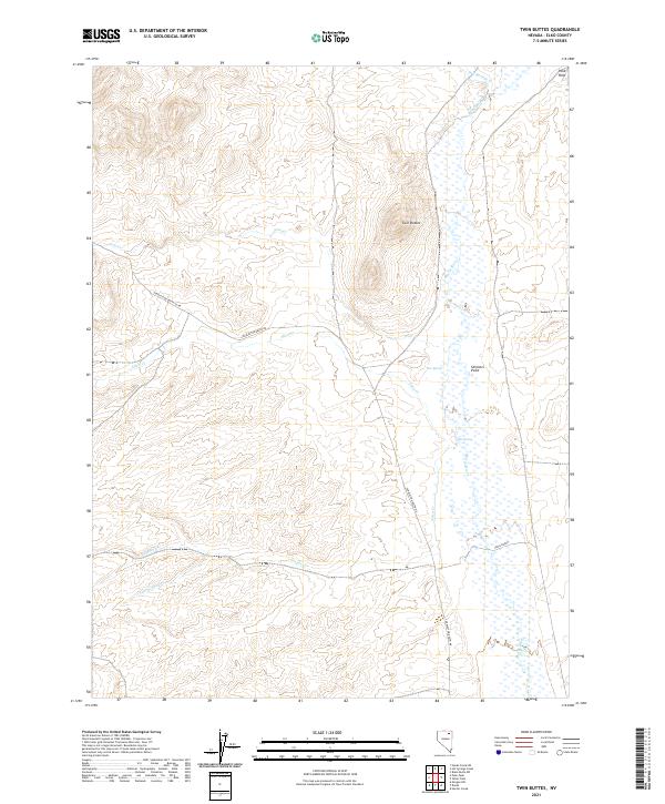
2021 Map of Twin Buttes
USGS Topo · Published 2021About this map
The Marys River valley defines this high-desert basin in northern Nevada, where an expansive network of wetlands and seasonal watercourses like Hot Springs Cr and Allen Cr converge. The landscape is punctuated by the isolated peaks of Twin Buttes and the elevated terrain of Skinners Point, while the Peko Hills rise in the northeastern corner. This area serves as a significant transit corridor through the sagebrush steppe, centered on the Charleston-Deeth Co Rd and various secondary routes like Cross Ranch road.
Find a feature on this map
22 named features on this map. Tap any name to fly to it.
Don’t see what you’re looking for? This feature index may not catch every label — zoom into the map to look around manually.
Map Details
Editions of this 2021 Twin Buttes Map
This is the sole edition of this map. No revisions or reprints were ever made.
Other maps of this area

1955 · Wells
USGS Topo · 1:250,000

1958 · Wells
USGS Topo · 1:250,000

1961 · Wells
USGS Topo · 1:250,000

1967 · Hanks Creek SW
USGS Topo · 1:24,000

1967 · Black Butte SW
USGS Topo · 1:24,000

1967 · Hot Springs Creek
USGS Topo · 1:24,000

1967 · Twin Buttes
USGS Topo · 1:24,000

1967 · Peko Peak
USGS Topo · 1:24,000

1967 · Herder Creek
USGS Topo · 1:24,000
1967 · Deeth
USGS Topo · 1:24,000