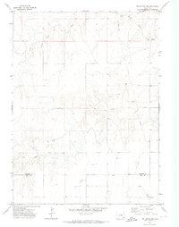
1971 Map of Twin Buttes
USGS Topo · Published 1973About this map
The high plains of the Colorado borderlands are defined here by the winding drainages of North Butte Creek and Two Butte Creek, which carve through the arid landscape of Prowers and Baca Counties. Mapping based on 1969 aerial photography reveals a region deeply tied to its water sources, with numerous Wells distributed across the prairie to support livestock and habitation. A single isolated Grave in the northwestern quadrant serves as a poignant reminder of the early settlers who worked this remote terrain. The presence of a prominent Pipeline and scattered Gravel Pits indicates the evolving industrial footprint of the early 1970s, while the southern reaches are marked by the seasonal flow of Little Bear Creek as it nears the state line.
Find a feature on this map
8 named features on this map. Tap any name to fly to it.
Don’t see what you’re looking for? This feature index may not catch every label — zoom into the map to look around manually.
Map Details
Editions of this 1971 Twin Buttes Map
This is the sole edition of this map. No revisions or reprints were ever made.
Other maps of this area

1899 · Sidney
USGS Topo · 1:125,000

1953 · Tamarack Ranch
USGS Topo · 1:24,000

1953 · Crook
USGS Topo · 1:24,000

1953 · Twin Buttes
USGS Topo · 1:24,000

1953 · Proctor
USGS Topo · 1:24,000

1953 · Haystack Butte
USGS Topo · 1:24,000

1953 · Julesburg Reservoir
USGS Topo · 1:24,000

1954 · Sterling
USGS Topo · 1:250,000

1954 · Scottsbluff
USGS Topo · 1:250,000

1958 · Scottsbluff
USGS Topo · 1:250,000