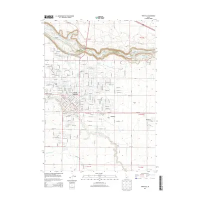
2013 Map of Twin Falls
USGS Topo · Published 2013About this map
Twin Falls and the surrounding agricultural landscape are defined by the deep gorge of the Snake River, which marks the boundary between Jerome and Twin Falls counties. This 2013 survey illustrates the modern footprint of the city as it extends toward the canyon rim, anchored by the Coll of Southern Idaho and numerous residential developments. The area's dependence on large-scale irrigation is evident in the presence of the Low Line Canal and the Orchalara Seepage Tunnel, critical components for the region's high-desert farming. Significant natural landmarks including Shoshone Falls and Pillar Falls punctuate the river's path, while the Perrine Memorial Bridge provides a vital link across the chasm. To the east, the settlement of Kimberly and the McMillan Siding reflect the continued importance of the railroad in moving local produce from facilities like Champlin Farms.
Find a feature on this map
152 named features on this map. Tap any name to fly to it.
Don’t see what you’re looking for? This feature index may not catch every label — zoom into the map to look around manually.
Map Details
Editions of this 2013 Twin Falls Map
This is the sole edition of this map. No revisions or reprints were ever made.
Other maps of this area

1950 · Filer
USGS Topo · 1:24,000

1950 · Jerome
USGS Topo · 1:24,000

1950 · Jerome
USGS Topo · 1:62,500

1955 · Twin Falls
USGS Topo · 1:250,000

1958 · Twin Falls
USGS Topo · 1:250,000

1964 · Kimberly
USGS Topo · 1:24,000

1964 · Falls City
USGS Topo · 1:24,000

1964 · Twin Falls
USGS Topo · 1:24,000

1964 · Perrine
USGS Topo · 1:24,000

1965 · Stricker Butte
USGS Topo · 1:24,000