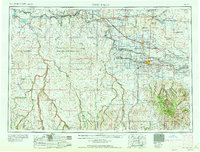
1958 Map of Twin Falls
USGS Topo · Published 1958About this map
The Snake River carves a deep path across the Idaho high desert in the mid-1950s, anchoring a landscape of irrigation and military utility. The established city of Twin Falls serves as the regional hub, connected to the north by the Perrine Memorial Bridge. Surrounding agricultural settlements like Filer, Buhl, and Kimberly contrast with the open, arid terrain to the west, where the Saylor Creek Aerial Gunnery Range occupies a massive swath of the Bruneau Valley.
Find a feature on this map
73 named features on this map. Tap any name to fly to it.
Don’t see what you’re looking for? This feature index may not catch every label — zoom into the map to look around manually.
Map Details
Editions of this 1958 Twin Falls Map
2 editions found

Other maps of this area

1892 · Mountain Home
USGS Topo · 1:125,000

1892 · Bisuka
USGS Topo · 1:125,000

1892 · Camas Prairie
USGS Topo · 1:125,000

1893 · Mountain Home
USGS Topo · 1:125,000

1893 · Camas Prairie
USGS Topo · 1:125,000

1894 · Bisuka
USGS Topo · 1:125,000

1936 · Mountain City
USGS Topo · 1:62,500

1936 · Rowland
USGS Topo · 1:48,000

1939 · Owyhee
USGS Topo · 1:62,500

1940 · Rowland
USGS Topo · 1:62,500