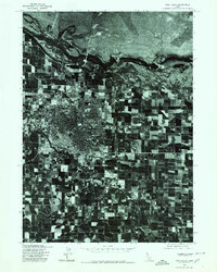
1976 Map of Twin Falls
USGS Topo · Published 1980About this map
This 1976 orthophotograph of Rock Creek captures the high-contrast transition between the dense residential grid of the city and the vast irrigation patterns of the surrounding Snake River Plain. Produced in cooperation with the Soil Conservation Service, this aerial survey reveals the intricate geometry of the agricultural landscape, where square fields are sharply delineated from the meandering course of the canyon. The imagery highlights the town's expansion toward the canyon rim, providing a clear visual record of mid-1970s land use and urban development in this part of Southern Idaho. The deep incision of Rock Creek remains the primary natural landmark, carving through the orderly layout of farms and subdivisions that define the local topography.
Find a feature on this map
1 named feature on this map. Tap any name to fly to it.
Don’t see what you’re looking for? This feature index may not catch every label — zoom into the map to look around manually.
Map Details
Editions of this 1976 Twin Falls Map
This is the sole edition of this map. No revisions or reprints were ever made.
Other maps of this area

1950 · Filer
USGS Topo · 1:24,000

1950 · Jerome
USGS Topo · 1:24,000

1950 · Jerome
USGS Topo · 1:62,500

1955 · Twin Falls
USGS Topo · 1:250,000

1958 · Twin Falls
USGS Topo · 1:250,000

1964 · Kimberly
USGS Topo · 1:24,000

1964 · Falls City
USGS Topo · 1:24,000

1964 · Twin Falls
USGS Topo · 1:24,000

1964 · Perrine
USGS Topo · 1:24,000

1965 · Stricker Butte
USGS Topo · 1:24,000