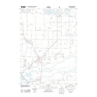
2012 Map of Twin Lake
USGS Topo · Published 2012About this map
Twin Lakes serves as the focal point for this 2012 survey, where North Lake, West Lake, and several smaller basins like Crocker Lake dot the upper landscape. The map captures a transition from the lakeside community at Twin Lake Cem down to the industrial and natural drainage of the Muskegon River valley. This lower reach is characterized by the complex hydrology of the N Channel Muskegon River and Fourmile Cr as they approach Muskegon Lake.
Find a feature on this map
128 named features on this map. Tap any name to fly to it.
Don’t see what you’re looking for? This feature index may not catch every label — zoom into the map to look around manually.
Map Details
Editions of this 2012 Twin Lake Map
This is the sole edition of this map. No revisions or reprints were ever made.
Other maps of this area

1929 · Montague
USGS Topo · 1:48,000

1930 · Lake Harbor
USGS Topo · 1:48,000

1930 · Muskegon
USGS Topo · 1:62,500

1936 · Muskegon
USGS Topo · 1:62,500

1936 · Lake Harbor
USGS Topo · 1:62,500

1954 · Milwaukee
USGS Topo · 1:250,000

1958 · Milwaukee
USGS Topo · 1:250,000

1958 · Twin Lake
USGS Topo · 1:62,500

1959 · Montague
USGS Topo · 1:62,500
1972 · Sullivan
USGS Topo · 1:24,000