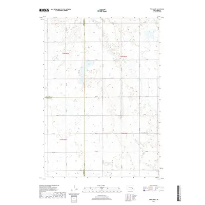
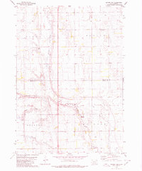
2017 Map of Twin Lakes
USGS Topo · Published 2017About this map
The shallow waters of Twin Lakes and Grass Lake dominate the landscape at the intersection of Jerauld, Sanborn, and Aurora counties. This prairie terrain is defined by its precise section-line road network, where routes like 394th Ave and 238th St trace the underlying township grid. Intermittent drainage features such as Dry Run snake through the open fields, illustrating the hydrology of this eastern South Dakota agricultural region. The map preserves the exact alignment of county roads including Co Rd 7 and Co Rd 80, which provided the primary connectivity for farming families across Blaine Township in the early twenty-first century.
Find a feature on this map
30 named features on this map. Tap any name to fly to it.
Don’t see what you’re looking for? This feature index may not catch every label — zoom into the map to look around manually.
Map Details
Editions of this 2017 Twin Lakes Map
This is the sole edition of this map. No revisions or reprints were ever made.
Other maps of this area

1898 · Huron
USGS Topo · 1:125,000

1899 · Mitchell
USGS Topo · 1:125,000

1953 · Huron
USGS Topo · 1:250,000

1954 · Huron
USGS Topo · 1:250,000

1955 · Mitchell
USGS Topo · 1:250,000

1959 · Mitchell
USGS Topo · 1:250,000
1973 · Forestburg SW
USGS Topo · 1:24,000
1973 · Woonsocket
USGS Topo · 1:24,000
1973 · Lane
USGS Topo · 1:24,000
1979 · Fraser Dam
USGS Topo · 1:24,000