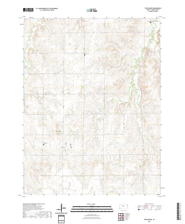
2022 Map of Twin Mound
USGS Topo · Published 2022About this map
Twin Mound rises as a prominent landmark in this section of Rooks County, anchored by a traditional township-and-range grid. The landscape is defined by the drainage systems of Elm Creek in the northwest and Medicine Creek in the southeast, which cut through the high plains terrain. This modern survey reflects the enduring rural structure of the region, where a network of section-line roads like 22 Road and T Road connect isolated homesteads and agricultural tracts. For those researching local heritage, the map identifies three distinct burial sites: Twin Mound Cemetery, Johnson Cemetery, and Survey Cemetery, providing precise coordinates for genealogical study in a sparsely populated landscape.
Find a feature on this map
24 named features on this map. Tap any name to fly to it.
Don’t see what you’re looking for? This feature index may not catch every label — zoom into the map to look around manually.
Map Details
Editions of this 2022 Twin Mound Map
This is the sole edition of this map. No revisions or reprints were ever made.
Other maps of this area

1896 · Plainville
USGS Topo · 1:125,000

1953 · Woodston NW
USGS Topo · 1:24,000

1953 · Stockton
USGS Topo · 1:24,000

1953 · Woodston
USGS Topo · 1:24,000

1955 · Beloit
USGS Topo · 1:250,000

1959 · Beloit
USGS Topo · 1:250,000
1978 · Natoma
USGS Topo · 1:24,000

1978 · Plainville
USGS Topo · 1:24,000
1978 · Codell
USGS Topo · 1:24,000
1978 · Twin Mound
USGS Topo · 1:24,000