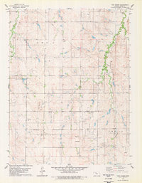
1978 Map of Twin Mound
USGS Topo · Published 1979About this map
Medicine Creek and Elm Creek carve paths through this section of Rooks County during the late 1970s, a period defined by the visible infrastructure of the energy industry. The landscape is marked by a pervasive Oil Field, with numerous Oil Wells and a major Pipeline cutting across the terrain. These industrial features contrast with the area's rural foundations, evidenced by several small family or community burial grounds including Johnson Cem, Survey Cem, and Twin Mound Cem.
Find a feature on this map
19 named features on this map. Tap any name to fly to it.
Don’t see what you’re looking for? This feature index may not catch every label — zoom into the map to look around manually.
Map Details
Editions of this 1978 Twin Mound Map
This is the sole edition of this map. No revisions or reprints were ever made.
Other maps of this area

1896 · Plainville
USGS Topo · 1:125,000

1953 · Woodston NW
USGS Topo · 1:24,000

1953 · Stockton
USGS Topo · 1:24,000

1953 · Woodston
USGS Topo · 1:24,000

1955 · Beloit
USGS Topo · 1:250,000

1959 · Beloit
USGS Topo · 1:250,000
1978 · Natoma
USGS Topo · 1:24,000

1978 · Plainville
USGS Topo · 1:24,000
1978 · Codell
USGS Topo · 1:24,000
1978 · Laton
USGS Topo · 1:24,000